This set of walks follow various public footpaths and bridleways that exist in the open country around Burston and Shimpling. All footpaths are shown on the OS Explorer map 230, although some sections vary slightly to follow field margins rather than any official route across crop fields. This means walkers do not damage crops which helps ensure continued access across our local farmland. None of these walks should take more than one hour to complete. Happy walking.
If you find a problem with any of the walks suggested on this page or any of the footpaths in the Parish please email footpaths@burstonandshimpling.org.uk with the details and we will investigate for you.
Norfolk County Council have an interactive map showing an overview of all the Public Rights of Way (PRoW) here Norfolk County PRoW Map
Burston
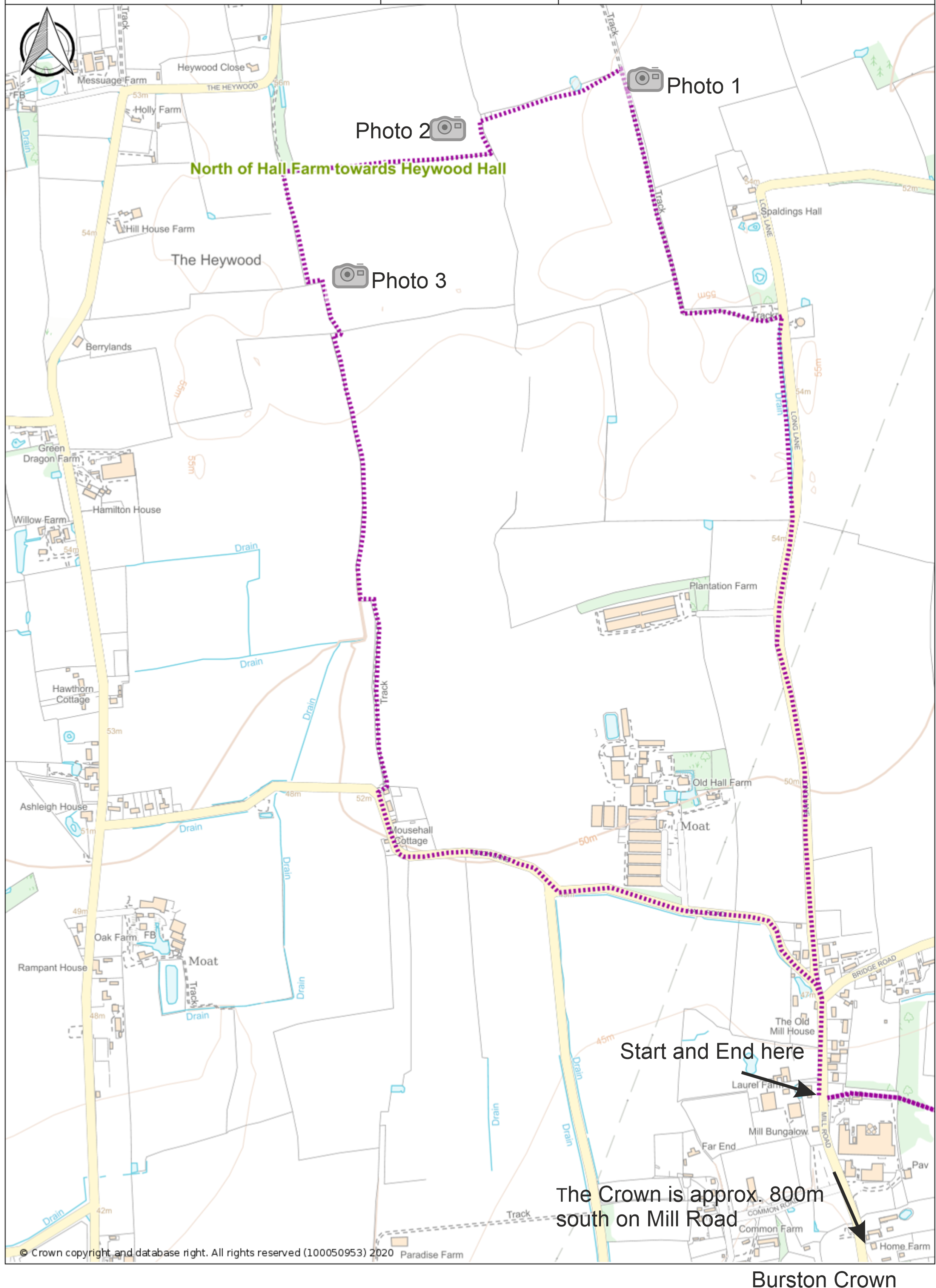 A circular walk north of Old Hall Farm towards Heywood Hall
North of Hall Farm towards Heywood Hall
Parish Walk – North Hall Farm – complete walk as pdf
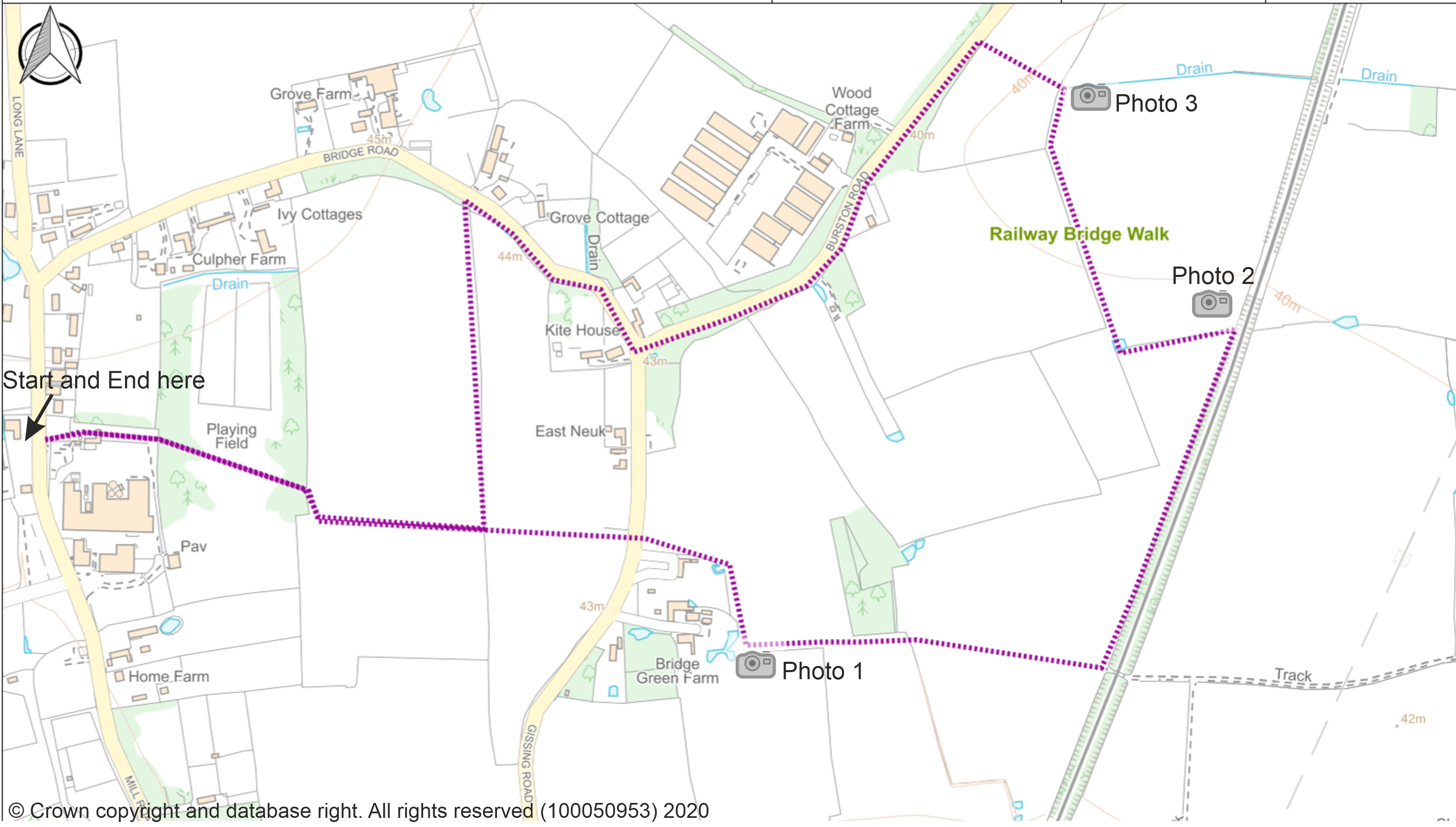
This walk takes you across open fields from Mill Green towards Shimpling and Gissing
Parish Walk – Railway Bridge Walk – complete walk as pdf
 This walk starts on Church Green and takes you across open fields to Audley End, returning via the Burston Crown
Parish Walks – Market Lane and Audley End – complete walk as pdf
Shimpling
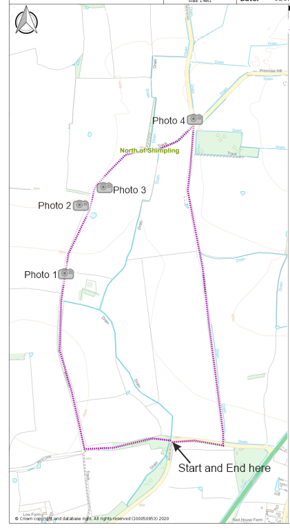 A circular walk including part of Boudicca’s Way
Parish Walk – North of Shimpling – complete walk as pdf